Section Branding
Header Content
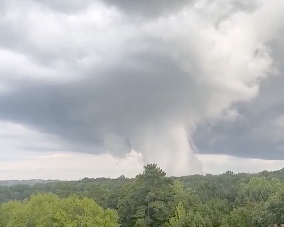
Was this a tornado in Atlanta? No, just a 'scud' cloud, weather experts say
Hero Image
Primary Content
The Atlanta Braves lost to the Los Angeles Angels at Truist Park on Tuesday evening after several storms passed through the area.
But one cloud formation worried fans as the game was set to start.
At around 7 p.m., a mushroom-shaped cloud with a long cylindrical tail made its way across the sky about a mile south of the stadium along the Chattahoochee River. It was visible to travelers on I-75 and a large part of Northwest Atlanta.
The cloud looked like scenes from the movie Twister.
Atlantans began posting images on social media sites, wondering what was happening.
"People are witnessing something similar to a tornado in Cobb County," Gafollowers wrote on Instagram.
Luckily, local weather forecasters jumped in to set the record straight.
"That’s a scud cloud," WSB-TV's Brad Nitz posted on X. "Warm moist air rising in a thunderstorm updraft and the water vapor condenses. It’s harmless, but scary looking. No rotation is the key to recognizing scud, not tornado."
"SCUD stands for 'Scattered Cumulus Under Deck,' meteorologist Chris Holcomb wrote on WXIA-TV's website. "Scud clouds form as warm moist air at the surface can mix in with colder air from the cloud descending downward from the cloud deck. That warm moist air condenses which makes the cloud is extending down from the cloud base close to the ground. Sometimes this extension of the cloud can look like a corkscrew trying to reach to the ground. There's nothing dangerous about this at all."
The National Weather Service in Peachtree City chimed in: "A great example of a scary looking, albeit harmless cloud that we in the business call Scud. Storms are still out there though, so stay weather aware through the night!"
The NWS website has a handy guide for understanding the difference between tornadoes and other cloud presentations.
Secondary Content
Author

Bottom Content
