Section Branding
Header Content
This Week In Georgia Weather - February 13th
Primary Content

It's finally starting to feel like winter again! An arctic air mass moved into the state over the weekend, causing temperatures to drop over 30 degrees and potentially damaging many fruit crops. Wintry mix will also be a threat for the northern portion of the state through Tuesday afternoon - the National Weather Service has issued a Winter Weather Advisory for the northeastern counties, including Dawson and Pickens up to Habersham and Rabun.
The Winter Weather Advisory is in effect midnight through 10:00am Tuesday morning. Light snow and freezing rain is expected throughout the advisory period. (Scroll to the bottom of this blog to find out more information about wintry weather and the criteria the NWS uses to issue advisories.)
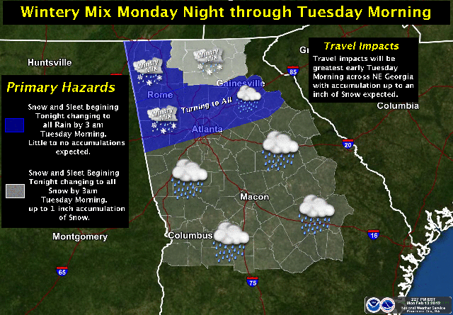
Areas outside of the advisory are also urged to use caution Monday night through Tuesday afternoon. The National Weather Service anticipates a mixture of rain and sleet to fall within north Georgia, including the Atlanta area. Air and surface temperatures are expected to remain in the mid-to-upper 30’s, limiting the potential for heavy sleet and snowfall. However, slick spots on bridges and overpasses may develop, and caution should be used during travel.
By Tuesday afternoon, all wintry weather is expected to melt and become rain. Up to one-quarter of an inch of precipitation is expected to accumulate through Tuesday evening.
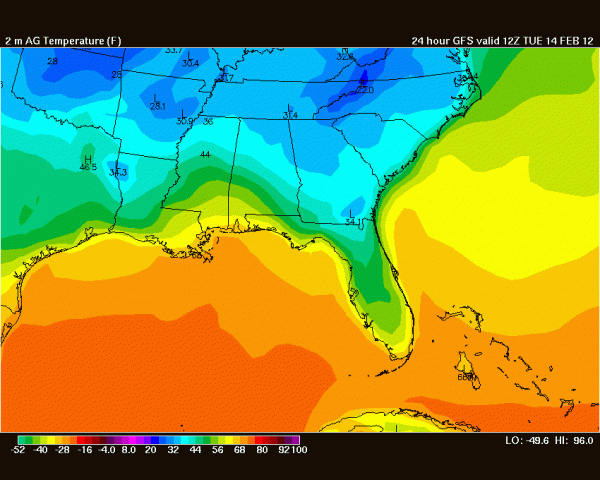
Forecast temperatures for 7am Tuesday. Image courtesy of Wright-Weather.com.
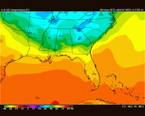
Forecast temperatures for 7pm Tuesday. Image courtesy of Wright-Weather.com
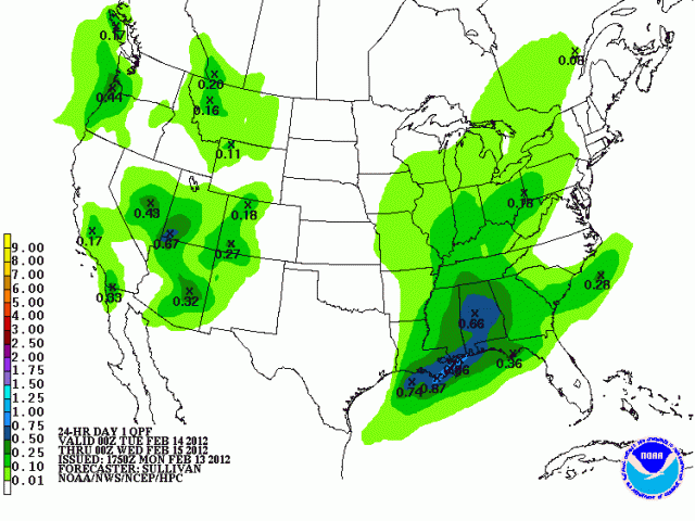
Forecast precipitation amounts for the period spanning from 7pm Monday through 7pm Tuesday. Image courtesy of the HPC.
The cold temperatures will not stick around for long - daytime highs will rebound back into the upper-50s and mid-60s by Wednesday. Temperatures will remain in the 50s and 60s through the end of the week. You'll still need the trench coat and the galoshes, though - rain returns early Thursday morning.
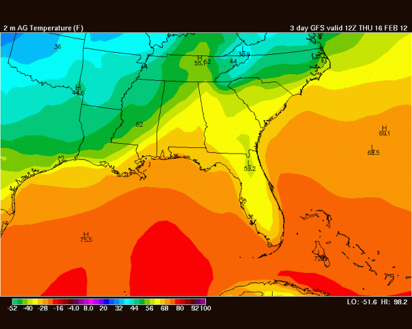
Forecast temperatures for 7am Thursday. Image courtesy of Wright-Weather.com.
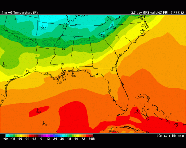
Forecast temperatures for 7pm Thursday. Image courtesy of Wright-Weather.com.
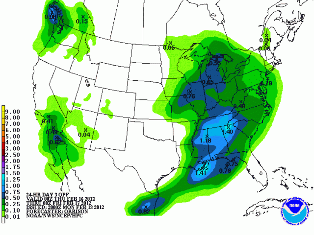
Forecast precipitation amounts for the period spanning from 7pm Wednesday through 7pm Thursday. Image courtesy of the HPC.
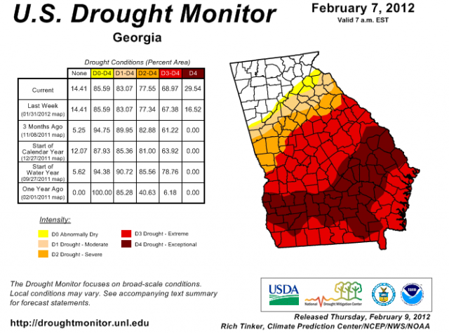
I'm crossing my fingers that all of this rain will help mitigate the extreme drought situation in south Georgia. I'm also hoping that the Georgia peaches weren't harmed from this weekend's hard freeze!
Winter Weather Awareness Information from GPB and the National Weather Service
Steve Nelson of the NWS explains the different types of winter weather alerts that affect Georgia.
Steve Nelson of the National Weather Service describes how meteorologists predict winter weather.
Barry Gooden explains the different types of frozen precipitation that can occur in the winter.
Additional Posts You May Like
Winter Weather Awareness Week, Day 1: Types of Winter Weather
Winter Weather Awareness Week, Day 2: Types of Winter Weather Alerts
Winter Weather Awareness Week, Day 3: Preparing for the Storm
Winter Weather Awareness Week, Day 4: Staying Safe
Winter Weather Awareness Week, Day 5: Winter Climatology
Secondary Content
Bottom Content


