Banner Image
Blog

Section Branding
Header Content
Soggy Start to September!
Primary Content
The first day of Fall is right around the corner (September 23rd!), and right as it seems that the summer heat has baked everything to an oblivion, rain has returned to the wonderful state of Georgia. About 80 percent of the state is experiencing extreme drought conditions, so a rainy forecast is certainly good news! However, keep an eye on the forecast, for we may receive too much of a good thing.

According to State Climatologist David Stooksbury, the summer of 2011 was the hottest ever on record for the cities of Alma, Athens, Augusta, Columbus, and Savannah. Both Macon and Atlanta experienced their third hottest summers this year. I will highlight the toasty details in a later post, but suffice it to say, it sure has been hot this year!!

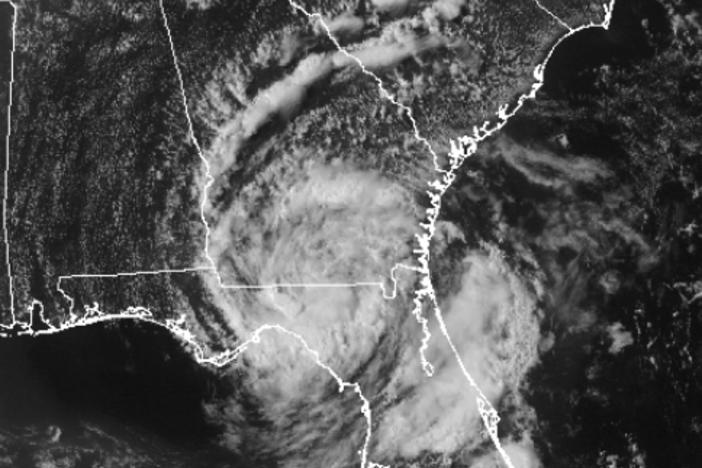
It has also been an active hurricane season with 12 named storms, two of which reached hurricane status. One particular tempest is Tropical Storm Lee, which formed in the Gulf of Mexico on Thursday, September 1st in the Gulf of Mexico. TS Lee made landfall over Vermilion Bay in Louisiana, and is currently moving towards the northeast at 3 mph. This puts the state of Georgia in the path of Tropical Storm Lee, and thankfully we will receive copious amounts of rain from this storm.

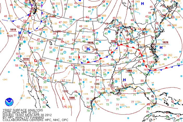
To the northwest, in the Ohio River Valley, a low pressure system and associated cold front will swing into Georgia on Monday. Air flows counter-clockwise around low pressure systems, and this means that the wind will blow from the southwest as the cold front approaches Georgia. This southwestern wind flow will also advect, or push, Tropical Storm Lee further into the state.

Both the cold front and the tropical storm are associated with heavy showers and storms; TS Lee is also forecasted to take his time exiting the state, and he is not expected to leave until Thursday. This sets the stage for flooding, with the Hydrological Prediction Center forecasting that most of the state will receive 1-3 inches of rain; some areas may experience as much as 5 to 9 inches of rain!

One silver lining to the exceptional drought conditions is that Georgia’s soil will be able to absorb a lot of the downpours, thereby alleviating some of the threat of flooding. However, there is only so much rain the ground can accept, so the National Weather Service in Peachtree City has issued a Flash Flood Watch for much of north and central Georgia. Be sure to stay alert to any flood warnings and advisories, and take action when necessary – inland flooding is the number one weather killer in the United States.

Another weather hazard related to landfalling tropical cyclones is tornadoes. When rain bands associated with tropical cyclones swirl over land, the friction from the ground terrain causes brief spin ups within the cyclone’s thunderstorms. These spin ups can spawn tornadoes that briefly touch down and cause damage in the tropical cyclone’s path. At this time, the Storm Prediction Center has issued a tornado watch for southwestern Georgia, including the cities of Albany, Moultrie, and Bainbridge, and for the metro Atlanta counties. Be sure to monitor your NOAA weather radio for any potential tornado warnings.
As we swing into September, keep in mind that we are in the peak of the Atlantic hurricane season. While the temperatures may be cooling off here inland, the ocean temperatures are still quite warm. Hurricane season does not come to a close until November 30th, so be sure to plan any fall trips to the beach accordingly!
Stay safe, and happy storm spotting!
Related Posts You May Like
Tour Through The Hurricane Hunters' Airplane!
If A Storm Brews In The Tropics, Is It A Tropical Storm?
Tropical Disturbances, Depressions, and Storms: Oh My!
A Hurricane By Any Other Name Would Still Be As Stormy
The first day of F
Secondary Content
Author

Bottom Content