Caption
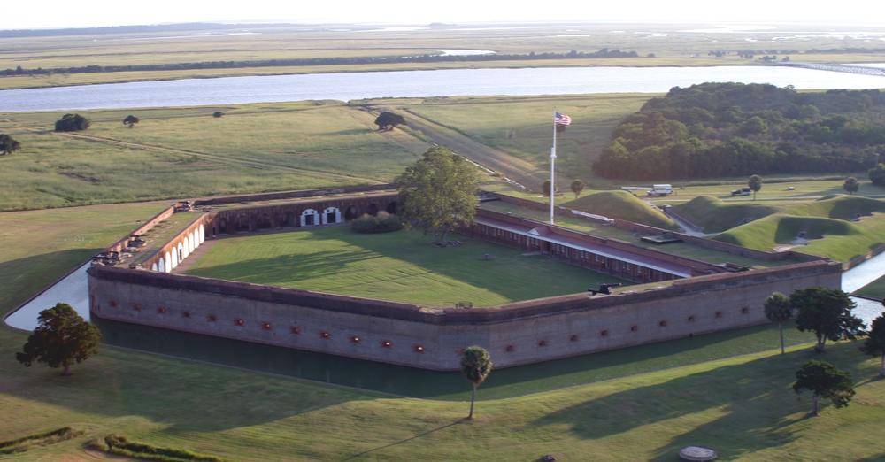
Fort Pulaski National Monument sits on Cockspur Island, located between Savannah and Tybee Island at the mouth of the Savannah River. The river's south channel is seen at top.
Credit: National Park Service
LISTEN: The Civil War-era seaside fort and adjoining park are grappling with the effects of climate change, prompting federal officials to adapt. GPB's Benjamin Payne reports.
As sea levels rise along Georgia's coast amid global warming, the National Park Service is asking for input on how to help adjust Fort Pulaski National Monument to the changing environment.
Nestled on low-lying Cockspur Island, where the Savannah River meets the Atlantic Ocean, the Civil War-era fort and adjoining park has seen “substantial sea-level rise in the last eight decades,” Fort Pulaski ranger Joel Cadoff said. “And that only looks to continue as we move into the future.”
The federal agency is accepting online comment until July 12 on its development concept plan, which focuses specifically on adapting park facilities, rather than the fort itself.
“We're not raising the fort; we can't take those 13 million bricks and put [them] higher,” Cadoff said with a laugh. “However, with the infrastructure that ultimately serves that, we can do a better job.”
For instance, the plan calls for a new and centralized maintenance facility to be built on slightly higher ground. The current facilities were built in the 1940s.
“We still have marked on the walls where the the surge of [Hurricanes] Matthew and Irma came into those buildings,” Cadoff said. “So, they are very susceptible.” Additionally, some NPS staff currently work out of temporary trailers that are not resilient to storm surge.
The agency stated bluntly in the plan that “recent storms and continued sea-level rise have exacerbated the physical decline of some important park facilities.”
Fort Pulaski typically experiences two to five storms per year, according to the NPS. Before each one, staff spend up to four days relocating equipment to higher ground, either on Cockspur Island or offsite.
“Timely response after storm events is challenging when equipment and supplies are stored in makeshift locations around the island,” the plan states. “Clean up and reopening to the public are negatively impacted, as well as ensuring the U.S. Coast Guard and park partners have access to their facilities.”
Aside from coping with sea-level rise, the project envisions changes meant to enhance the visitor experience, including more parking and an improved picnic area.
Perhaps most notably, it suggests relocating the park entrance gate from its current location just off U.S. Highway 80 — which Cadoff said “can be very dangerous” as cars line up near the busy road — to a safe location on Cockspur Island.
“We really want to know what what people like,” he said of the overall plan. “We want to know what people don't like. And if there's something we're not even thinking about, we want to know, because this is really the time that the public can have vital, important input on the things that we do.”
More information about the project can be found on the agency's story map, which includes interactive visuals that pinpoint the precise location of proposed changes.
NPS staff have also scheduled a public meeting on Thursday from 5 to 7 p.m. at Fort Pulaski National Monument's visitor center, where the agency will provide information, field questions and gather feedback.

