Section Branding
Header Content
A new satellite could help clean up the air in America's most polluted neighborhoods
Primary Content
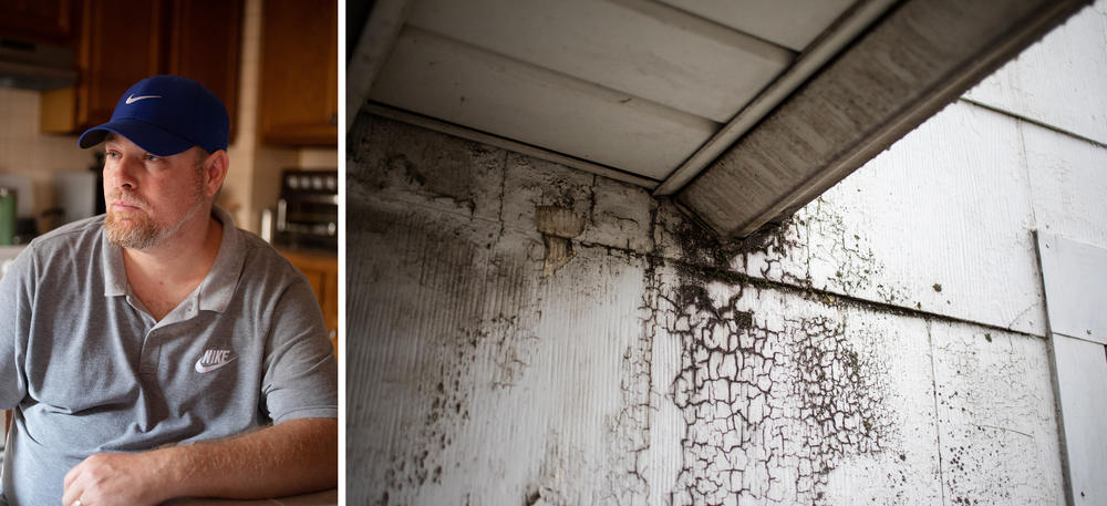
David Jones dusts his house in the Curtis Bay neighborhood of Baltimore almost daily. He rarely opens his windows, even when the weather is beautiful, because the outdoor air makes him feel sick.
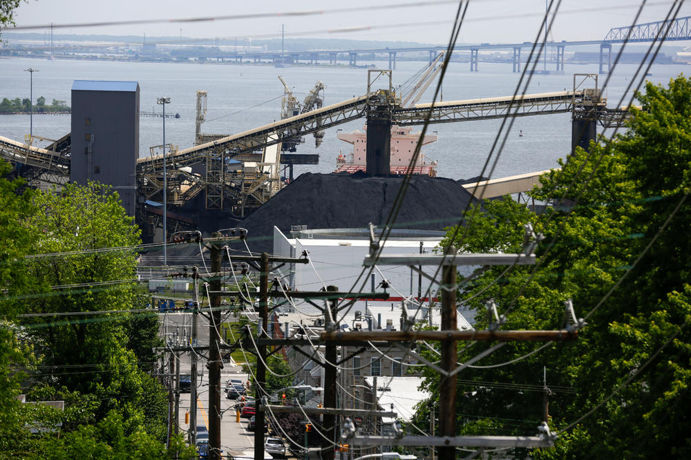
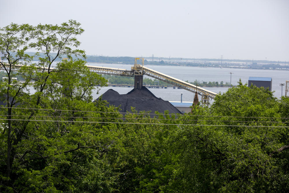
Immediately across the street is the Curtis Bay coal terminal, where heaps of coal taller than Jones' house are piled up for overseas shipment. Dust from the coal mounds enters people's cars, homes — and lungs.
"You wake up in the morning and your throat hurts," Jones says. In the bathroom sink, he can see black specks in his spit.
Jones is one of millions of people in the United States who live with dangerous air pollution, including gases like nitrogen oxide and sulfur dioxide, ground-level ozone and tiny particulates that coat every surface. Some particles are so small they worm deep into the lungs and cross into the brain.
Sustained exposure to air pollution causes some cancers and respiratory and cardiovascular diseases, and it exacerbates a host of other ailments. People who breathe polluted air ultimately lead shorter, sicker lives.
But data on U.S. air pollution is patchy and incomplete. An existing network of federal air monitors is too spread out to capture a complete picture of who is being exposed to what, and when.
Now, a new satellite instrument called TEMPO, which stands for Tropospheric Emissions: Monitoring of Pollution, is about to deliver a dramatic upgrade to that data. The TEMPO satellite offers near-continuous air pollution information about the entire country. The instrument, which launched this spring and is coming online this summer, is a collaboration between NASA, the National Oceanic and Atmospheric Administration (NOAA) and the Smithsonian Astrophysical Observatory.
The goal is to provide the data necessary to reduce air pollution and to forecast poor local air quality more accurately — for example, during wildfires, heat waves or industrial disasters, according to NOAA. NASA developed a similar satellite with South Korea that launched in 2020 and collects data over Asia, and a third with the European Space Agency that is expected to launch next year over Europe.
Communities with disproportionately high amounts of dangerous air pollution, like Curtis Bay, potentially stand to gain the most from the new TEMPO satellite data.
"This is a satellite that's going to hover just over the United States and take snapshots of the air over the United States throughout the entire day," explains Susan Anenberg, director of the Climate and Health Institute at George Washington University Milken Institute School of Public Health. "It's a major advance."
There are persistent air pollution disparities in the U.S.
While the air in the U.S. has been getting steadily cleaner since the Clean Air Act was passed in 1970, socioeconomic disparities persist. The places with the most pollution decades ago — including pockets of Southern California, southeast Texas and an industrial swath of the Midwest and Northeast — are still the most polluted today.
Poor and working class communities and communities of color around the country, including Curtis Bay, bear the disproportionate impacts of air pollution.
In Curtis Bay, the single-biggest source of pollution is the coal export terminal. Freight trains haul cars of uncovered coal through the community to the terminal, where the coal is unloaded and stored in multistory piles until they can be loaded onto ships.
Steady truck traffic also spews diesel pollution into the neighborhood.
Studies by Johns Hopkins University and the Environmental Integrity Project show that Curtis Bay has some of the highest emissions of industrial pollutants in Maryland.
Curtis Bay residents have been fighting for cleaner air for years. In 2016, local activists successfully blocked plans to build a waste incinerator in their neighborhood, which would have brought even more air pollution.
But their larger battle for clean air continues. And one of the most potent tools in that fight is data.
Tracking air quality in Curtis Bay is labor-intensive
Community organizers who are pushing for stricter regulation and greater enforcement say that more granular data is evidence they can use to push companies and government officials to crack down on pollution.
"It's absolutely critical," says Greg Sawtelle, a community organizer with the South Baltimore Community Land Trust. "[Data] is useful in order to substantiate what residents have known for a long, long time."
But getting detailed information about what is in the air can be challenging. Government air monitors aren't in every neighborhood. And until now, there was only one snapshot of U.S. air pollution taken daily from space, making it impossible to get real-time information.
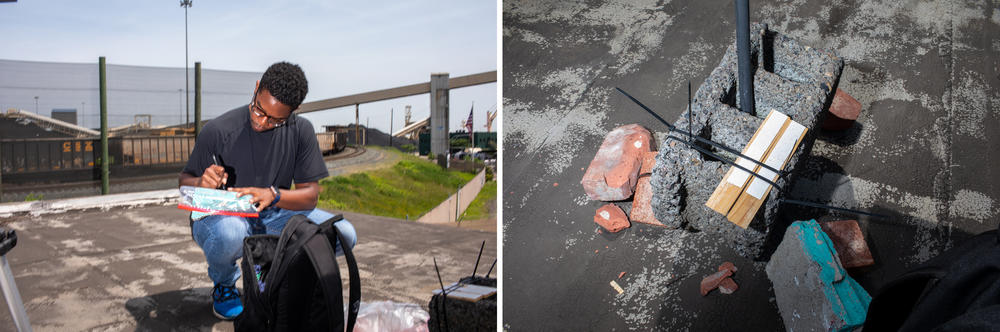
As in other disproportionately polluted neighborhoods across the country, residents in Curtis Bay have turned to researchers for help gathering supplemental data about what they are breathing to fill in the gaps.
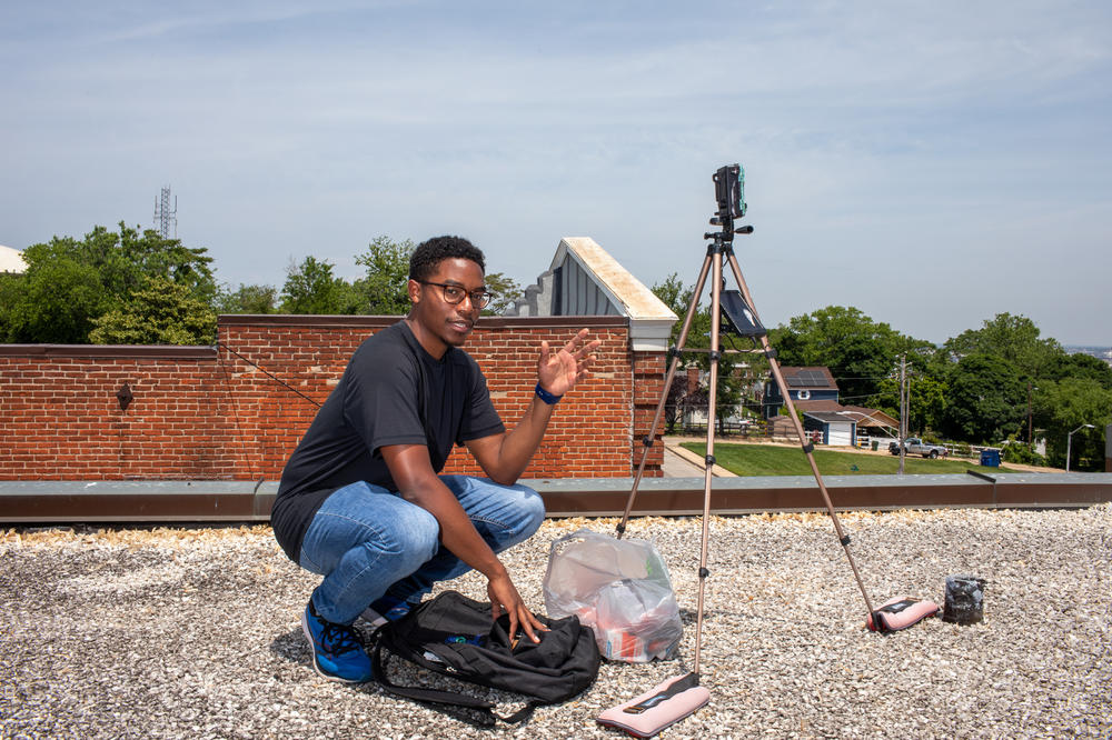
A team from Johns Hopkins University has been working with residents who want more information about local air quality. The researchers have installed multiple air monitors near homes and businesses, and they are monitoring dust from the coal terminal, as well as dangerous gases that come from tailpipes.
But monitoring air quality this way is labor- and resource-intensive, and it's infeasible to install enough monitors to cover every neighborhood grappling with polluted air.
The new satellite offers more detailed information
Starting in late August, the new satellite will take hourly measurements of three major air pollutants across the country. The TEMPO instrument can gather data on sections of a city, allowing it to provide information about neighborhoods like Curtis Bay. It will offer the most accurate picture to date of where air pollution is concentrated in the U.S. and how that pollution fluctuates throughout the day. For example, some types of pollution are higher during rush hour or after a freight train passes through a neighborhood.
"I think we could be using satellite data to create a more comprehensive view of which communities across the country are overburdened by pollution," Anenberg says.
The Environmental Protection Agency agrees. The agency sees the satellite as "a big step forward," according to a statement to NPR.
Anenberg points out that there are limits to what the new data might reveal. Decades of research have already shown that low-income and minority communities across the country experience disproportionate air pollution.
Anenberg says it's up to officials to use the new data to protect vulnerable communities.
"We can't put the responsibility on individuals to take action. This is the responsibility of governments," Anenberg says.
Under current law, the EPA, which is responsible for regulating air pollution, isn't required to use the new data to shape its enforcement and rule-making activities.
But the agency says it is exploring ways to use the satellite data with its own ground-based air pollution monitors as a potential tool to combat environmental injustice. "TEMPO's high frequency and fine spatial resolution may help identify pollution sources that affect disproportionately polluted neighborhoods," according to the EPA's statement.
One immediate use for the data could be to provide real-time information about wildfire smoke. The EPA's AirNow site is the main source of information about air quality, and adding hourly satellite data could make it more accurate and useful. The agency is working on that upgrade.
Copyright 2023 NPR. To see more, visit https://www.npr.org.
Bottom Content
