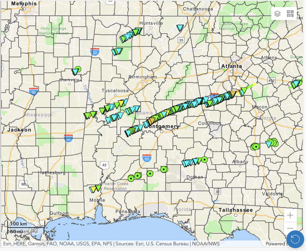
Caption
A National Weather Service interactive map shows multiple lines of storms moving across Alabama and Georgia on Jan. 12, 2023
Credit: NOAA/NWS
LISTEN: Kyle Theim from the National Weather Service discusses the storms that occurred in Georgia on Jan. 12, 2023.
Tornadoes ripped through Alabama and Georgia on Jan.12, 2023, killing nine people. The National Weather Service has identified the rare and damaging system as "mesocyclonic."
An interactive graphic on the NWS website showed the paths of several lines of storms that day which began in Eastern Mississippi before losing strength just west of Augusta, Ga., also affecting Tennessee, Kentucky and the Carolinas.
Agency meteorologist Kyle Thiem told GPB News as many as four tornadoes were circulating around a larger circulation as they approached hard-hit Griffin, Ga., on Jan. 12.
"The added spin of the storms intensified the tornadic circulations at the point in time," he said. "And we found a correlation with more extreme damage that was documented whenever these circulations merged together."
The Center for Storm Prediction helps forecasters identify and predict storms. Its website explains mesocyclones, multi-vortex tornadoes and a satellite tornadoes:
This dance of tornadoes is more commonly seen in the Midwest's Tornado Alley. Could more mesocyclonic storms occur across the Southeast this spring?
While it's difficult to predict the number of severe storms or tornadoes each year, more than 200 tornadoes have been reported in the U.S. since Jan.1. Higher than average water temperatures, warm, moist air and La Niña patterns can make conditions ripe for an active season.
As such, the NWS is collecting data about this season's storms in an atmospheric study funded by the National Science Foundation (NSF) and the National Oceanic and Atmospheric Administration (NOAA).
The PERiLS (Propagation, Evolution, and Rotation in Linear Storms) campaign will measure the atmosphere near and inside storms with a focus on quasi-linear convective systems — commonly known as squall lines — that produce tornadoes. NOAA will gather data through May 8 in mid-and lower-Mississippi Valley eastward to the foothills of the Appalachian Mountains.
The study area covers the states hardest hit by the Jan. 12 storms.