Section Branding
Header Content
After Extreme Drought in Some Areas of Georgia, Meteorologist Predicts Rain, Cooler Temperatures
Primary Content
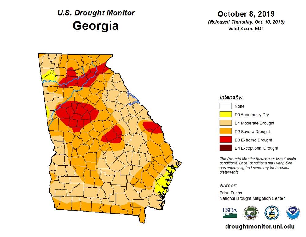
The latest drought monitor report notes pockets of “extreme drought” appearing across Georgia. As of Oct. 8, 2019, areas north and south of Atlanta, in central Georgia and near the South Carolina border, are currently experiencing dry conditions characterized by major damage to agriculture.
Dry conditions were also met with heat, with an October heatwave setting multiple new records across the state.
Greg Postel, meteorologist at The Weather Channel, joined On Second Thought to look at long term trends and what weather patterns are in store for fall and winter.
On Second Thought host Virginia Prescott speaks with Greg Postel.
Postel says warm, dry conditions often beget more of the same. “It’s a positive feedback loop where the warm and the hot conditions dry out the ground, make it even warmer and hotter, which, that pattern tends to deflect the rain away,” Postel explains.
Postel predicts a cooler and wetter second half of October — a good sign for improved farming conditions and a lowered risk of forest fires.
Get in touch with us.
Twitter: @OSTTalk
Facebook: OnSecondThought
Email: OnSecondThought@gpb.org
Phone: 404-500-9457
Secondary Content

Bottom Content
