Section Branding
Header Content
Hurricane Lee will bring heavy rain to already saturated areas of New England
Primary Content

Updated September 14, 2023 at 3:37 PM ET
The good news is that Hurricane Lee is weakening and will keep doing so before making landfall near the U.S.-Canada border. The bad news is that it will bring dangerous winds and a massive amount of water to areas that are already saturated from heavy rainfall this summer.
"Regardless of Lee's designation when it approaches New England and Atlantic Canada, it will remain a very large and dangerous cyclone through landfall," the National Hurricane Center said on Thursday.
Here are the latest things to know about Lee:
New England is under watches and warnings
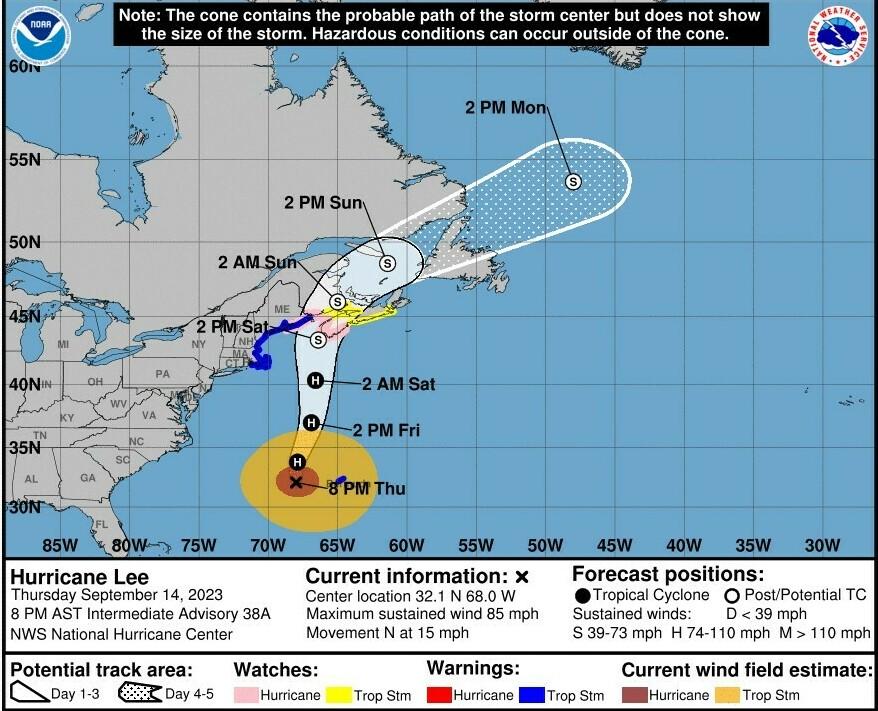
Parts of Maine and Canada are under a hurricane watch, meaning hurricane conditions are possible within 48 hours. The alert is in effect from Stonington, Maine, to Canada's New Brunswick and Nova Scotia.
Part of coastal Massachusetts is now under a tropical storm warning, including Nantucket, Martha's Vineyard, and Cape Cod, the hurricane center said in an update Thursday. That means tropical storm conditions are expected in the warning area within 36 hours.
"Impacts are expected to be greatest across Cape Cod, where winds may gust as high as 50-60mph," the National Weather Service office in Boston said.
Lee's storm surge could cause problems across a broad area. And for much of the U.S. East Coast, forecasters warn of perilous rip currents and surf from the storm.
4 inches of rain could fall in 24 hours
Lee's winds and rains are expected to start hitting the U.S. coast Friday night. In the following 24 hours, the system could bring 1 to 4 inches of rainfall to parts of eastern New England, New Brunswick and Nova Scotia.
"This may produce localized urban and small stream flooding," the NHC said.
The storm's speed and its exact path will define many of these impacts: hurricanes' heaviest rains typically fall east of the center, and the effects are amplified when a storm slows down over land.
Lee is now a Category 1 storm
The hurricane is passing to the west of Bermuda, and its forward speed is picking up, reaching close to 15 mph as of 8 p.m. ET Thursday.
Lee is heading north; it's expected to curl more toward a northeast track over the weekend. Along the way, its winds will lose strength and it will speed up even more over the water.
The NHC says the storm will approach the coast of New England and Atlantic Canada Friday and Saturday, and move across Atlantic Canada Saturday night and Sunday.
Maine is preparing for wind and water
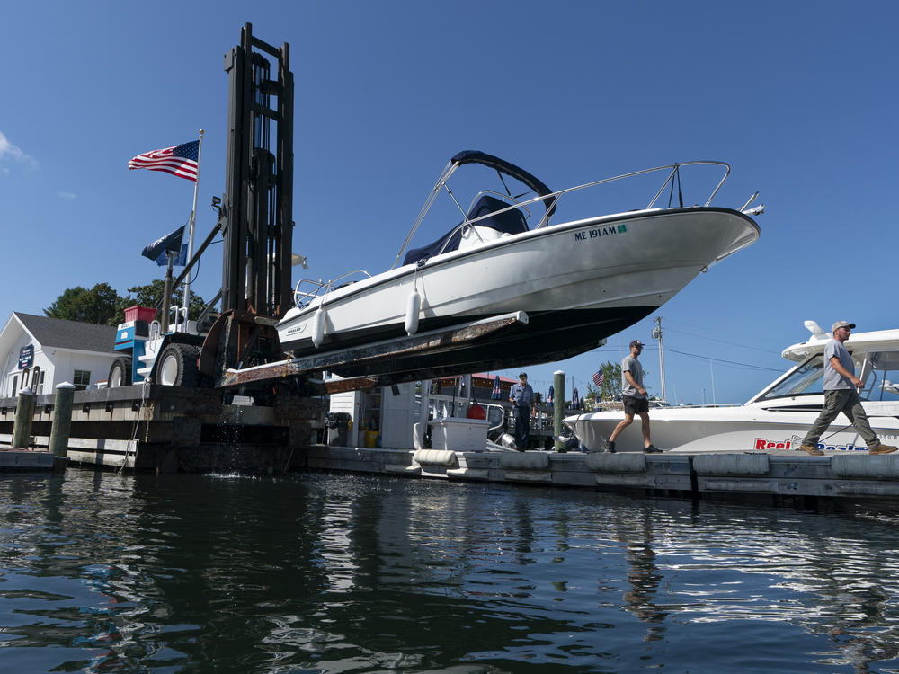
"Large waves and dangerous rip current are a certainty at this point, with 15-20 [feet] waves likely just offshore," the National Weather Service office in Portland, Maine, said Thursday morning.
On land, high winds could down trees and cause power outages — the NWS office warns that winds will increase Friday night, with gusts reaching about 45 mph in some areas on Saturday as the winds move inland.
The storm surge could bring 3 feet of floodwater
Areas stretching from Flushing, N.Y., to the Canadian border could see flooding of 1 to 3 feet if the storm surge peaks along with high tide, forecasters said. Long Island Sound, Martha's Vineyard, Nantucket and Cape Cod could also have 1 to 3 feet of surge.
"There is the potential for life-threatening storm surge flooding in portions of southeastern Massachusetts, including Cape Cod and Nantucket, late Friday and Saturday," according to the hurricane center.
New England has already been drenched by heavy rainfall

"The last Category 1 hurricane to come from the sea and make landfall in Maine was more than a half-century ago," NPR's Tovia Smith reported on Morning Edition.
The storm isn't expected to carry that status into this weekend — but by any measure, Lee is arriving at a bad time. Many parts of New England are still recovering from flooding and heavy rainfalls this summer, with some areas seeing 5 to 15 inches more rain than normal in the past 90 days.
The huge storm is roiling beach conditions
Lee isn't the staggeringly strong hurricane it was one week ago, but it has continued to grow. As of early Thursday afternoon, it was extending tropical storm-force winds up to 310 miles from its center, with hurricane-force winds stretching up to 90 miles out.
The hurricane's energy has been spreading through the Atlantic, bringing treacherous rip currents and surf conditions to beaches on much of the U.S. East Coast.
For a sense of what that energy looks like out in the open water, picture 46-foot waves. That number comes from the National Hurricane Center's high seas forecast for the peak wave height associated with Hurricane Lee near its center, the agency said Thursday evening. Elsewhere, seas between 10 and 16 feet in mixed swells were expected within 480 nautical miles from the center.
Copyright 2023 NPR. To see more, visit https://www.npr.org.
Bottom Content
