Section Branding
Header Content
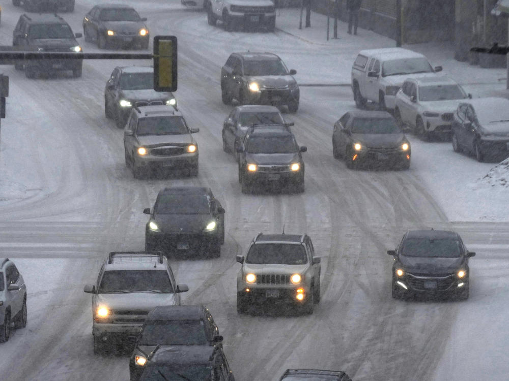
More than 2,300 flights canceled as heavy snow hits the Midwest
Primary Content

Updated February 22, 2023 at 4:20 PM ET
Residents of Northern states are hunkering down as heavy snow and high winds are threatening to create whiteout conditions on Wednesday afternoon and evening.
The National Weather Service predicted another round of storms would leave a foot of snow across South Dakota through Michigan.
A snowfall rate of up to 2 inches an hour, freezing temperatures and wind speeds of 50 mph could continue to make travel treacherous, if not life-threatening, across Wyoming, Wisconsin and Minnesota.
Flight cancellations began to rise on Wednesday morning. As of 11 a.m. ET, more than 2,300 flights had been canceled, with Minneapolis International Airport scrapping more than half of its arrivals, and more than 13,000 flights had been delayed. Airports in Denver, Detroit and Milwaukee were also heavily impacted.
Schools across Minnesota, Wisconsin and the Dakotas announced closures as roads became icy or closed entirely. Forecasters said as much as half an inch of ice could accumulate across the Great Lakes into Thursday, especially in places that don't see much snowfall.
An initial burst of storms already dropped several inches of snow across the Great Lakes yesterday. Parts of southwest Minnesota registered 7 inches of snow on Tuesday, according to MPR news.
A no-travel advisory and highway closures remained in effect in parts of the state as the governor said on Twitter that he would direct the state's National Guard, transportation department and state patrol to be ready to respond to emergencies.
In total, nearly half the country is predicted to experience some form of notable weather on Wednesday, the NWS reported in its daily bulletin.
In California, a trailing cold front sent wind speeds as high as 50-60 mph, threatening power lines. As of Wednesday morning, more than 110,000 homes and businesses were without power in parts of the state's Bay Area and Central Coast. Another 24,000 were without power in Arizona.
Snow also began to fall across Western mountain ranges on Wednesday, with as much as 2 feet expected in higher regions, the NWS said. That means lower elevations across California could see a winter mix, hail or heavy rain, a cause of anxiety for a state that's seen several rounds of deadly floods.
And Thursday may not bring relief: A second storm will approach the West Coast on Thursday, bringing threats of renewed rain and snow, the NWS says.
As temperatures in Southern California might not rise above 50 degrees, parts of the Southeast and Mid-Atlantic were expected to see highs in the 70s and 80s on Wednesday.
"The forecast temperature gradient from the Mid-Atlantic into New England Thursday is worth noting, as highs in the 80s in Virginia drop to the single digits in northern Maine," the NWS said in its bulletin.
If temperatures hit 80 degrees in Washington, D.C., on Thursday, as expected, they'd break the record of 78 degrees set in 1874, the AP reports.
But that warm front isn't likely to stick around for much longer. By Thursday, the same storm that's blanketing the plains will begin to slip into upstate New York and central New England, sending colder temperatures further south by the weekend.
Copyright 2023 NPR. To see more, visit https://www.npr.org.
Bottom Content
