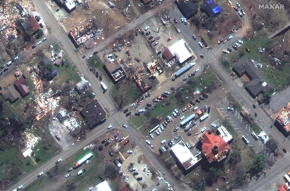
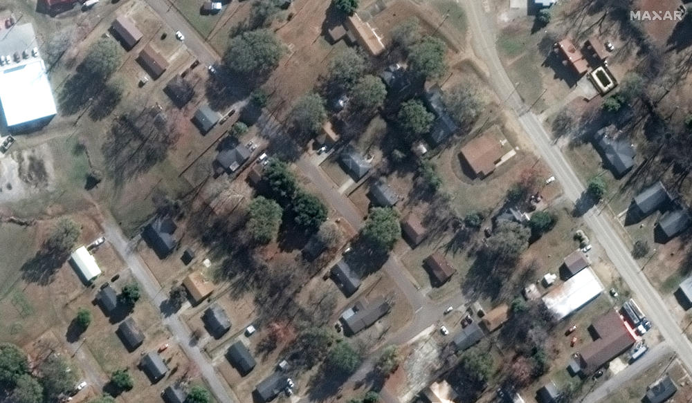
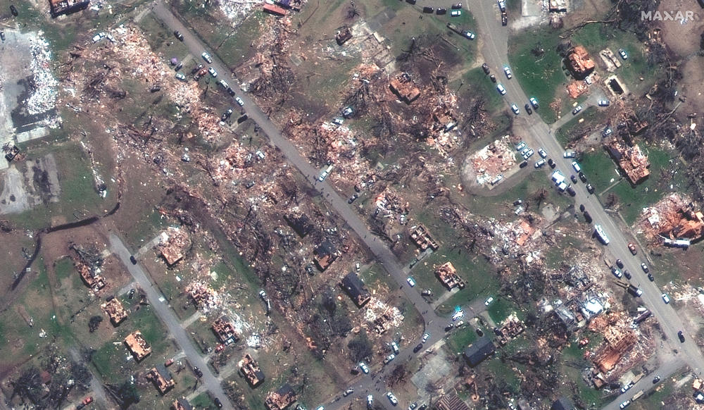
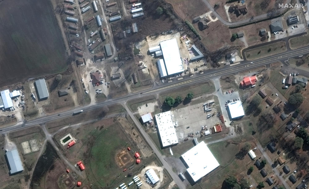
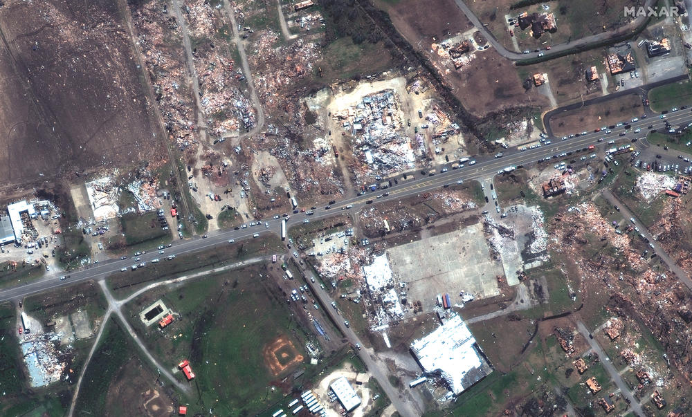
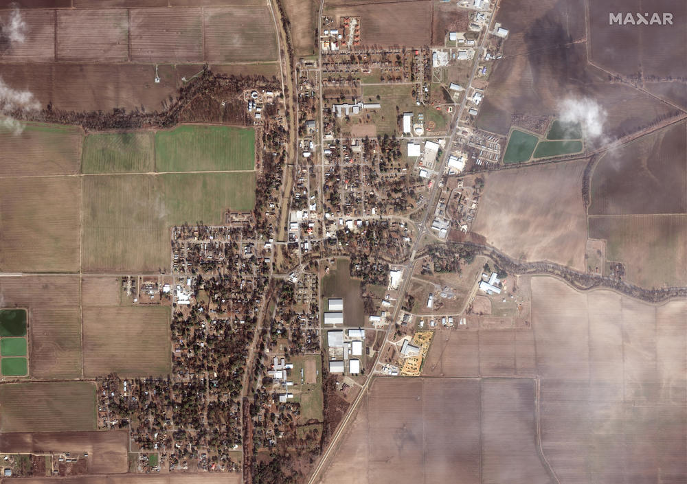
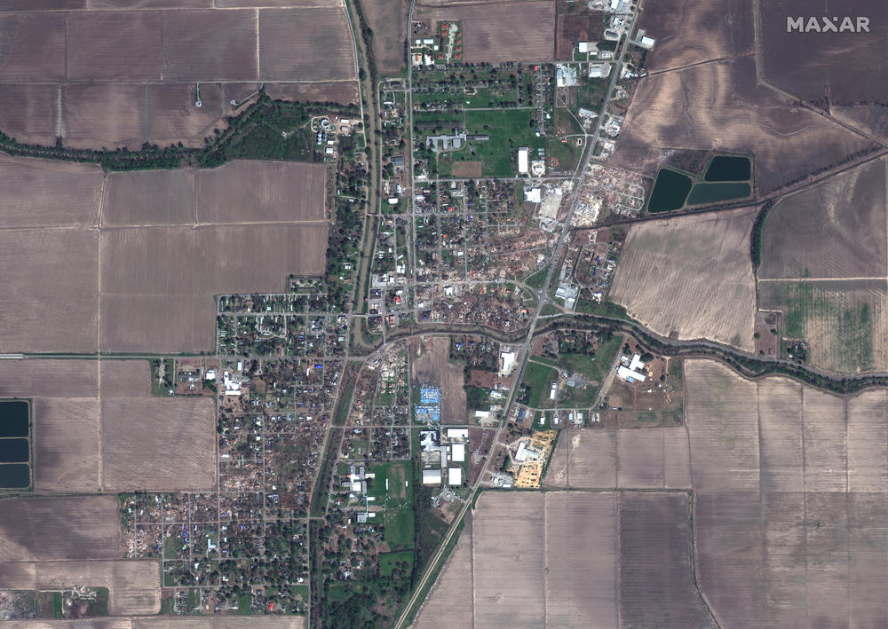
Satellite images released by Maxar on Sunday, March 26, show devastation in Rolling Fork, Mississippi, after a deadly tornado tore through the town on Friday night.

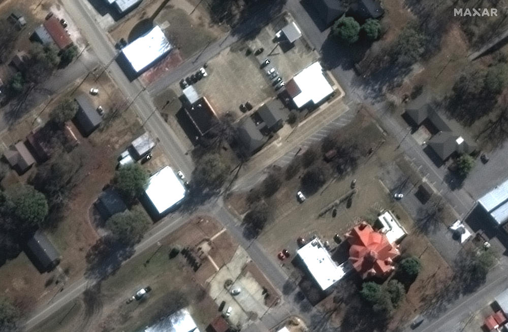
Maxar collected images from the town on Sunday and compared them to images collected on December 27, 2022, to show the destruction caused by Friday's tornado.

AFTER: Destroyed homes and buildings along Walnut Street in Rolling Fork, Miss. on March 26, 2023.
Caption

AFTER: Destroyed homes and buildings along Walnut Street in Rolling Fork, Miss. on March 26, 2023. / Satellite image ©2023 Maxar Technologies

BEFORE: Homes and buildings along Walnut Street in Rolling Fork, Miss. on Dec. 27, 2022.
Caption

BEFORE: Homes and buildings along Walnut Street in Rolling Fork, Miss. on Dec. 27, 2022. / Satellite image ©2023 Maxar Technologies

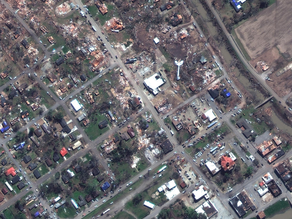
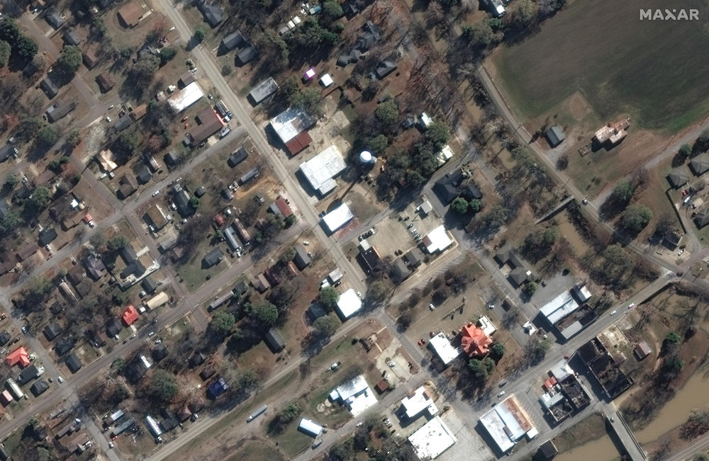
Extensive damage to buildings, homes and infrastructure can be seen across the area as the tornado moved from the southwest to the northeast directly through the town, Maxar said. At least 25 people were killed and dozens more injured after multiple tornadoes ripped through western Mississippi, officials said.

Copyright 2023 NPR. To see more, visit https://www.npr.org.

BEFORE: Tornado closer view of U.S. Post Office and county clerk office Walnut Street, Rolling Fork, Miss. on Dec. 27, 2022.
Caption

BEFORE: Tornado closer view of U.S. Post Office and county clerk office Walnut Street, Rolling Fork, Miss. on Dec. 27, 2022. / Satellite image ©2023 Maxar Technologies

AFTER: Closer view of damaged U.S. Post Office and county clerk office on Walnut Street, Rolling Fork, Miss. on March 26, 2023.
Caption

AFTER: Closer view of damaged U.S. Post Office and county clerk office on Walnut Street, Rolling Fork, Miss. on March 26, 2023. / Satellite image ©2023 Maxar Technologies

BEFORE: Tornado homes along Walnut and Mulberry Street, Rolling Fork, Miss. on Dec. 27, 2022.
Caption

BEFORE: Tornado homes along Walnut and Mulberry Street, Rolling Fork, Miss. on Dec. 27, 2022. / Satellite image ©2023 Maxar Technologies

AFTER: Destroyed homes along Walnut and Mulberry Street, Rolling Fork, Miss. on March 26, 2023.
Caption

AFTER: Destroyed homes along Walnut and Mulberry Street, Rolling Fork, Miss. on March 26, 2023. / Satellite image ©2023 Maxar Technologies

BEFORE: Businesses and homes near Blues Highway, Rolling Fork, Miss. in Dec. 27, 2022.
Caption

BEFORE: Businesses and homes near Blues Highway, Rolling Fork, Miss. in Dec. 27, 2022. / Satellite image ©2023 Maxar Technologies

AFTER: Destroyed businesses and homes near Blues Highway, Rolling Fork, Miss. on March 26, 2023.
Caption

AFTER: Destroyed businesses and homes near Blues Highway, Rolling Fork, Miss. on March 26, 2023. / Satellite image ©2023 Maxar Technologies

BEFORE: Overview of Rolling Fork, Miss. on Dec. 27, 2022.
Caption

BEFORE: Overview of Rolling Fork, Miss. on Dec. 27, 2022. / Satellite image ©2023 Maxar Technologies

AFTER: Overview of Rolling Fork, Miss. on March 26, 2023.
Caption

AFTER: Overview of Rolling Fork, Miss. on March 26, 2023. / Satellite image ©2023 Maxar Technologies