Caption
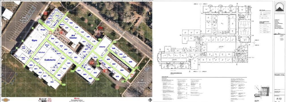
At left, a simulated school building's map rendered by Critical Response Group uses grid navigation and a standardized orientation of north facing up. At right, a traditional architectural blueprint of the same building shows what school districts without critical incident mapping use during emergencies.
Credit: Critical Response Group

