Section Branding
Header Content
At least 18 are dead after tornadoes rip through parts of Texas, Oklahoma, Arkansas
Primary Content
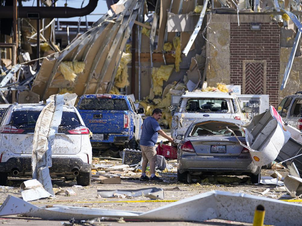
Powerful tornadoes and thunderstorms ripped through parts of Texas, Oklahoma and Arkansas late Saturday evening and Sunday morning, leaving at least 18 people dead and causing widespread damage.
Hundreds of thousands of residents were without power early Monday across a broad swath stretching from Texas to Virginia, according to the website poweroutage.us. Forecasters warned the greatest risk from storms will move east.
Kentucky Gov. Andy Beshear declared a state of emergency on X early Monday in his state. “Severe weather continues to move through the commonwealth with multiple reports of wind damage and tornadoes,” Beshear wrote.
On Sunday, Arkansas Gov. Sarah Huckabee Sanders said at a news conference the statewide death toll had increased to eight.
“Bryan and I are praying for the communities impacted by last night’s storm and the families of the Arkansans we lost,” Sanders said.
Texas Gov. Greg Abbott said “at least seven lives” had been lost due to the weekend storms.
The Oklahoma Department of Emergency Management said two fatalities had been confirmed in the town of Pryor in Mayes County.
In Louisville, Ky., Mayor Craig Greenberg confirmed one death.
Other states are preparing for more bad weather
The National Weather Service issued tornado warnings and severe thunderstorm warnings in Texas, Oklahoma, Kentucky and Arkansas throughout the Memorial Day weekend. The NWS office in Fort Worth said one of the storms was expected to contain “golf ball sized hail!”
On Sunday afternoon, a major swath of the U.S was facing an “enhanced risk” of severe weather, including large parts of the Ohio and Mississippi Valleys, according to the National Weather Service.
Severe thunderstorm watches were in effect Sunday for parts of Kentucky, North Carolina, Ohio, Tennessee, Virginia and West Virginia — with tornadoes and hail also possible.
“Additionally, heavy rain may lead to scattered instances of flash flooding with this initial burst of thunderstorms,” the weather service added. “By the afternoon hours another round of showers and thunderstorms are expected to develop along a cold front and impact similar regions, with the severe threat shifting further east across the Ohio Valley overnight.”
By Monday, meteorologists said the weather system will produce severe thunderstorms across the Mid-Atlantic, with the highest chance for intense rainfall in parts of Pennsylvania, New York and New Jersey.

