Section Branding
Header Content
Hurricane Season 2019: Where Do Hurricanes Get Their Names?
Primary Content
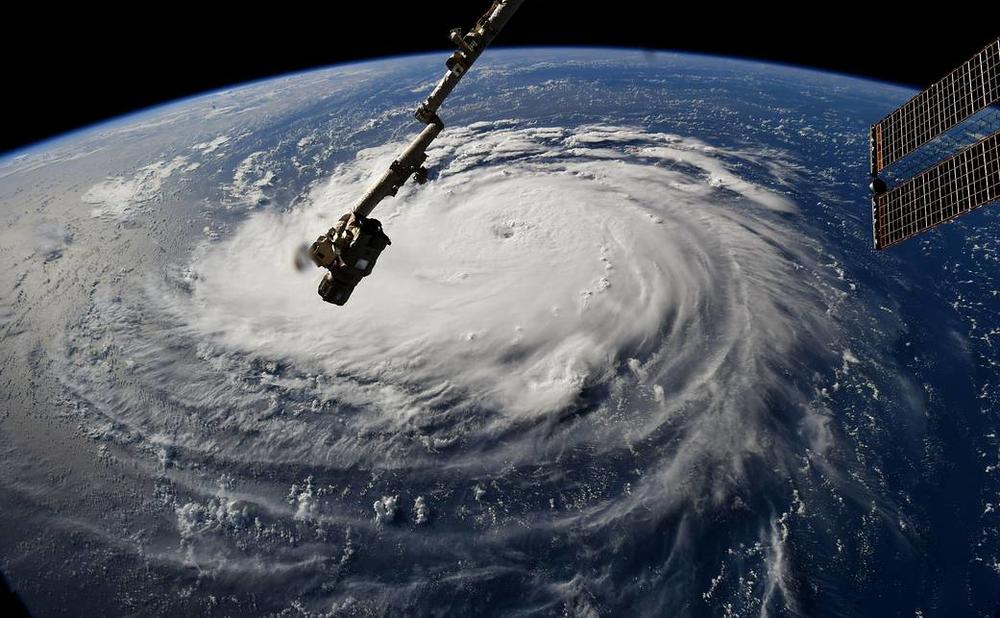
Forecasters at the National Hurricane Center monitor storm systems in the ocean long before they threaten land, and often identify tropical cyclones long before they become hurricanes.
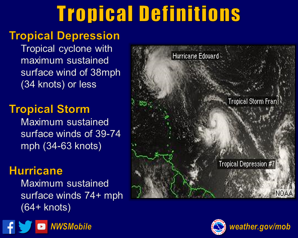
Storms like this only get names once they reach the level of a tropical storm, which have sustained wind speeds of 39 to 73 mph.
Once a storm is that strong, it gets a name drawn from an alphabetical list. Each year's first tropical storm gets an "A" name, Andrea this year. The names cycle every six years, so the next time we could see a Tropical Storm Andrea is 2025.
But if a storm is too deadly or costly, the World Meteorological Organization retires its name. The storms that have devastated parts of Georgia in recent years have all been retired; we will never have a Hurricane Michael, Irma or Matthew again. Other major storm names like Sandy, Katrina, Andrew and Hugo are also retired.
RELATED: Complete List Of Retired Hurricane Names
The Atlantic has seen five tropical storms so far in 2019: Andrea, Barry, Chantal, Dorian and Erin. The next storm to get strong enough for a name will be called Fernand.
Subtropical Storm Andrea
Andrea formed before the official, June 1 start of hurricane season, organizing east of the Bahamas on May 20, 2019. The storm weakened to a subtropical depression the following day, with winds of 35 miles per hour, and then dissipated.
Hurricane Barry
The first hurricane of the 2019 season, Hurricane Barry, formed in the Gulf of Mexico and strengthened into a hurricane on July 13. Barry made landfall as a Category 1 hurricane in Intracoastal City, Louisiana, then gradually weakened as it moved inland.
Hurricane Barry caused extensive damage in Louisiana, including in Lafayette, Lake Charles and Baton Rouge. One man was killed by a rip current off the coast of the Florida Panhandle on July 15.
Tropical Storm Chantal
Chantal formed in the North Atlantic on Aug. 21. It was brief and did not threaten land, and was forecast to become a remnant on Aug. 23.
Hurricane Dorian
Dorian formed on Aug. 24 and intensified to a hurricane on Aug. 28. It stalled over the Bahamas, devastating some areas. Dorian prompted an evacuation of the Georgia coast but ultimately had a limited impact in the state, mostly strong winds and power outages.
Tropical Storm Erin
A tropical depression far off the coast of the Carolinas intensified into Tropical Storm Erin on Aug. 27. By the following morning, it was again considered a tropical depression, forecast to travel north in the Atlantic Ocean before dissipating in the following days.
Tropical Storm Fernand
Fernand developed in the Gulf of Mexico Sept. 3 and made landfall in Mexico the following day. It quickly weakened to a tropical depression before dissipating Sept. 5.
Tropical Storm Gabrielle
The tropical depression that became Gabrielle formed Sept. 3, intensifying into a tropical storm overnight. It degenerated into a remnant Sept. 6 before picking up steam again and regenerating into a tropical storm. Remnants of Gabrielle struck the British Isles Sept. 12.
Hurricane Humberto
Humberto threatened the Bahamas Sept. 12 before it developed into a tropical cyclone. The storm ultimately strengthened to a tropical storm, passing east of the Abaco Islands Sept. 14, before later intensifying into a Category 3 hurricane. Humberto brought hurricane-force winds to Bermuda and is currently northeast of that island and forecast to travel further to the northeast.
Tropical Storm Imelda
Tropical Storm Imelda in the Gulf of Mexico weakened to a tropical depression before making landfall near Freeport, Texas, on Sept. 17. The storm brought heavy rainfall and flash flooding to parts of eastern Texas and southwestern Louisiana. Imelda continues to move northwest at just five miles per hour, and forecasters say the risk of further rain and flooding continues.
Hurricane Jerry
A tropical depression in the Atlantic strengthened into Tropical Storm Jerry Sept. 18, becoming a hurricane the following day. Forecasters are still tracking the storm, with tropical storm watches issued for several Caribbean islands. Jerry is expected to pass north of Puerto Rico and turn north rather than approach the US mainland.
Tropical Storm Karen
Tropical Storm Karen became the latest tropical system to lash the Caribbean over the weekend, AccuWeather said Monday, Sept. 23, and its impacts are expected to reach Puerto Rico in the coming days as it crawls through the Caribbean Sea.
Tropical Storm Lorenzo
A batch of thunderstorms that formed over Africa became Tropical Storm Lorenzo Tuesday, Sept. 24, and is likely to become the next hurricane of the 2019 season this week.
Lorenzo joins Jerry and Karen in the Atlantic basin. There is now a trio of active tropical systems spinning in the basin at the same time, and the latest addition is intensifying quickly, according to AccuWeather.
The 2019 Atlantic Hurricane Names:
- Andrea
- Barry
- Chantal
- Dorian
- Erin
- Fernand
- Gabrielle
- Humberto
- Imelda
- Jerry
- Karen
- Lorenzo
- Melissa
- Nestor
- Olga
- Pablo
- Rebekah
- Sebastien
- Tanya
- Van
- Wendy
This post will be updated throughout hurricane season.
Secondary Content

Bottom Content
