Section Branding
Header Content
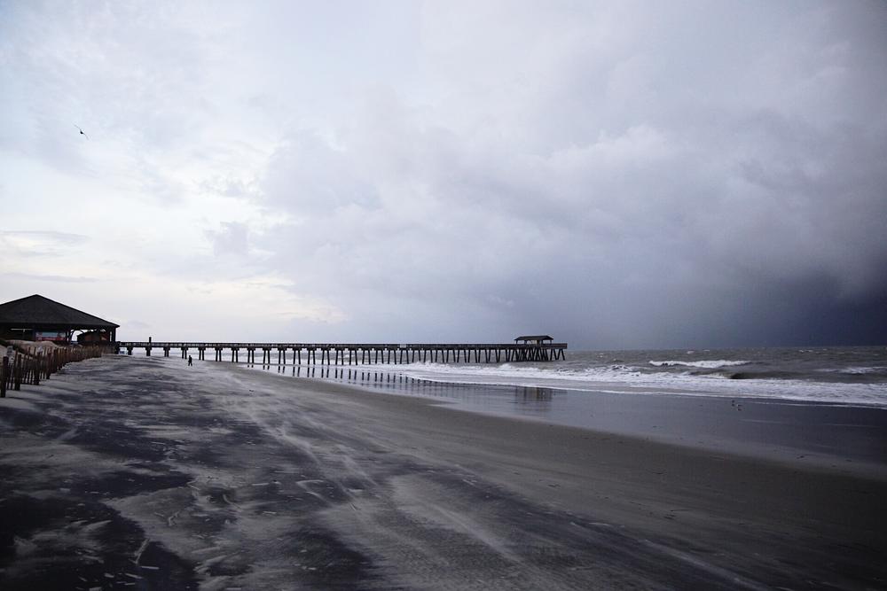
Tybee Island Feels Hurricane Dorian's Impact
Primary Content
As Hurricane Dorian moves toward Georgia, the storm's worst impacts are expected on the state's barrier islands, where storm surge flooding is likely. Forecasters expect serious issues to begin on Tybee Island with the 1 p.m. high tide Wednesday.
Conditions were already stormy on the Tybee beach this morning, with powerful wind and choppy surf. Rain from the storm's outer bands began falling in torrents before 8 a.m.
A few people watched the storm near the pier.
"I wanted to see the waves," said Jeanne Mallett of Savannah, who traveled the half hour to see the beach before the worst of the storm. "We don't see waves like this every day. I've been out here the last couple days and they just get stronger and stronger, so it's kind of cool to see how powerful the ocean really is."
Tybee resident Jerry Stuber checked the ocean at the morning low tide.
"Normally, where it is right now would be a low[er], high tide," Stuber said of the water. He expected flooding on the roads and said he planned to leave the island.
Paul Hughes of Whitemarsh Island visited the Tybee beach to check the waves.
"We're waiting for the hurricane, kinda the swell to come in and try to do a little bit of surfing," he said. "It's been a little bit rough though."
Tybee Island Mayor Jason Buelterman said he suspects fewer people evacuated than did for Hurricane Matthew in 2016, although similar effects are predicted for this storm. He said many were encouraged by Tybee no longer being in the cone showing Dorian's possible path.
"But just because we're out of it doesn't mean that we're not gonna be severely impacted," he said. "And there could be a lengthy impact, with power outages and bridge access issues."
Buelterman said some residents were waiting to evacuate until after the afternoon high tide goes down, a plan that will likely leave them driving through tropical storm force winds.
Forecasters expect storm surge of 3 to 5 feet above ground level. In an effort to protect the island from flooding, Tybee added sand to make up for spaces in the dunes.
"The surge tends to come through any gaps just like a broken dam," Buelterman said. "You don't want that to happen, so we had to fill in those gaps."
But much of the flooding from past storms on Tybee has come on the back side of the island that faces the river and marsh, which dunes cannot protect.
"I'm sure they're very, very nervous right now," Buelterman said. "And I feel for them, 'cause this is three out of the last four years, and if you have water in your house, your life is turned upside down."

Secondary Content

Bottom Content
