Banner Image
Blog

Section Branding
Header Content
Getting There From Here: Inquiry And Geo-Literacy In The Digital Age
Primary Content
Are you trying to meet a friend for lunch? Post your location or just "check in" where you are. Want to see if there's a quick way out of traffic? Pull up GPS. Although many districts, and even states, have given up teaching geography classes, the utility of the discipline keeps increasing. From tracking packages you buy online to storms approaching your area. Geographic Information Systems (GIS) are the ultimate combination of data analysis and practicality. As schools move away from filling in maps of far away countries to project and inquiry-based curriculum aimed at explaining the world's challenges as well as solving them, a new approach to geo-literacy is gaining ground. And with the ubiquity of mapping software in our digital world, students may just be perfectly placed to take notice. As geographer Joseph Kerski explains, the reason that GIS is so important is because, "the data that goes into...GIS has to do with real places, real environments, real people." So let's get down to business.
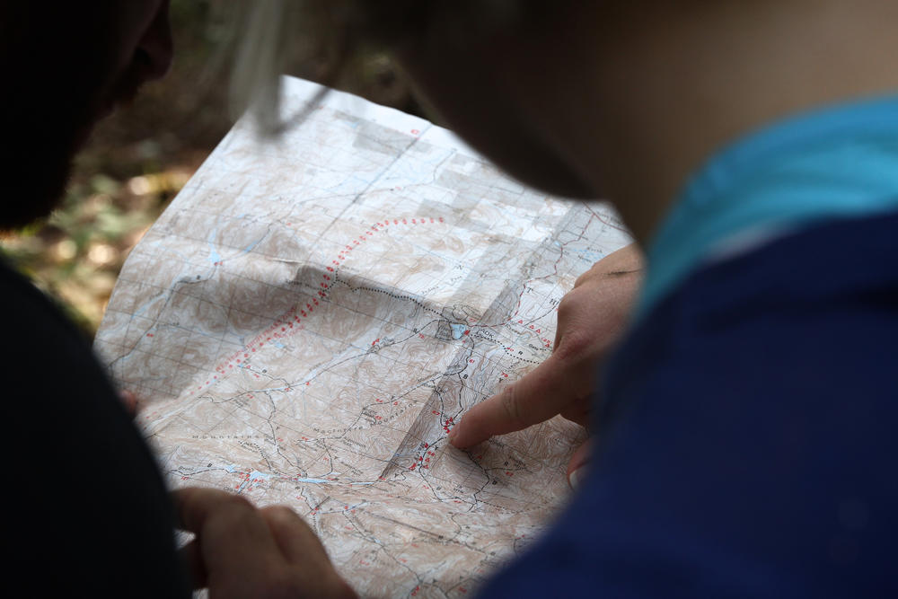
Teaching with maps enables students to learn through maps—that is, to think spatially—in various reasoning and probelm-solving contexts in the classroom and real world.
The world has become increasingly complex. We see it all around us. National Geographic's Road Map for 21st Century Geography Education clearly identifies that the interconnectedness of global society is a phenomenon students need to be better prepared to assess going forward if they are to remain competitive but also in the interest of making well-informed decisions. Data streams from our devices create digital portraits and maps of our behavior and used constantly by companies and governments and organizations to provide better products and services. So how can we get students interested in these systems and create curriculum surrounding these developing methods? Luckily quite a few educators and organizations are ahead of the curve and have struck a path for the rest of us.
For simple introductory lessons have a look at National Geographic. They offer a GIS in Action global map to help students understand the connection between maps and real situations, interactive GeoStories, and a digital mapmaker. Edutopia details a Geo-Literacy Project including a master plan with instructions for getting started. Their blog also explains the utility of such projects along with a list of resources and links that can be used in the classroom.
Although GIS Day isn't until November, there is a host of resources that could apply to everyday classroom learning. The official November 15, 2017, website has nearly fifty hands-on exercises broken down by grade band. For middle school lessons check out The Science Spot. Additionally, a professor at the University of West Georgia has developed middle school tutorials. Foothill College and San Jose University partnered to develop a "problem-based science" curriculum specifically for high school. For more information, the Palm Beach County School District's website has links to papers on integration, lesson plans, and resources for more information. And for more challenging tools, data mapping firm esri has instructional resources for all educational levels. Geospatial Historian is an online open textbook with lessons and tutorials on creating your own GIS resources. To build your own maps, have a look at the State Department's Mapgive.
But how do we approach such a rigorous topic and what if we don't have the fanciest technology? Geographers Sarah Witham Bednarz, Gillian Acheson, and Robert S. Bednarz wrote a piece for the National Council of Social Studies where they lay out goals and strategies for GIS education because, "teaching with maps enables students to learn through maps—that is, to think spatially—in various reasoning and problem-solving contexts in the classroom and real world." As the authors point out, students naturally view the content they are reading both in terms of visual images and written statements. So, to play to students' natural abilities, maps offer complex information visually and make processing that information more accessible. In short, "linking what with where, and reading and thinking with and through maps, makes content more memorable." They continue, offering a list of strategies for helping students be more "carto-literate."
- Have students approach issues from a problem-solving perspective by asking them to map a circumstance in two different ways. An example might be the number of babies born per state and then the number of babies born per state divided by the population of that state. Students can then discuss which map is more appropriate for measuring this information and why.
- For an inquiry approach, students can look at the northern regions of large countries like Russia and Canada to see how different maps portray them differently. Does one map show size or distance more accurately?
- To develop more critical thinking, have students collect examples of various maps from similar areas or regions across a variety of sources, like newspapers or magazines. In this way, students can compare perspectives, purposes, and biases of cartographers and organizations to better understand the information that maps convey.
If educators are looking for background reading or perhaps more rigorous suggestions from higher education, TeachGIS hosts college syllabi and textbooks for further study. Additionally, the University of Georgia hosts eHistory, a series of projects based on GIS. Check out their CSI Dixie, Pox Americana, Invasion of America, Mapping Occupation, and IndianNation projects for advanced resources.
As schools move away from filling in maps of far away countries to project and inquiry-based curriculum aimed at explaining the world's challenges as well as solving them, a new approach to geo-literacy is gaining ground. And with the ubiquity of mapping
Secondary Content
Author

Bottom Content