WATCH LIVE | The 2024 Georgia High School Music Theatre Awards At 8 P.M.
Section Branding
Header Content
Hurricane Delta's Winds Now At 110 MPH As Storm Approaches Louisiana Coast
Primary Content
Updated at 2:15 p.m. ET
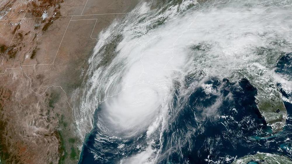
Hurricane Delta will bring a "life-threatening storm surge, destructive winds, and significant flooding" to the U.S. Gulf Coast, the National Weather Service says. The storm is at the upper limit for a Category 2 hurricane, with sustained winds of 110 mph.
The hurricane is forecast to make landfall late afternoon or evening on Friday. The National Weather Service office in New Orleans is warning residents, "Worsening conditions are expected through the day."
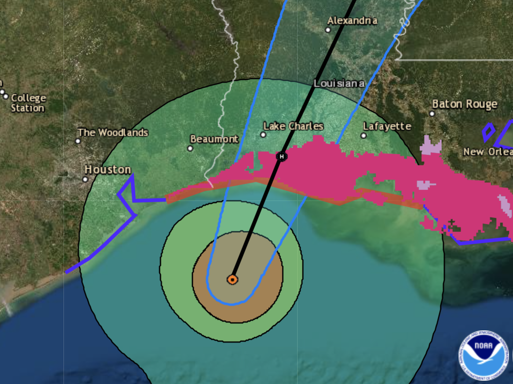
Delta is currently 80 miles south-southwest of Cameron, La., the National Hurricane Center said in a 2 p.m. ET update. The center of the storm is expected to make landfall just east of that town, which was hit hard by Hurricane Laura in late August. The system is moving north-northeast at 14 mph.
"The good news is that Delta is moving relatively quickly," so its torrential rains aren't expected to linger in the area, Louisiana Gov. John Bel Edwards said at a news briefing early Friday afternoon.
By noon local time, an observation buoy about 25 miles east of Galveston, Texas, was reporting sustained winds up to 52 mph, with gusts up to 60 mph.
"It's a very healthy storm," NHC Director Ken Graham said in an online briefing Friday morning.
Noting satellite imagery that shows clouds and vapor fanning out along the edges of the system, Graham added, "The air coming in, building that convection, and all those winds, and then the air coming out — you can see this thing basically breathing."
A hurricane warning is in effect from High Island, Texas, east of Galveston, to Morgan City, La., south of Baton Rouge. Delta's rains are already falling on southwestern Louisiana and southeast Texas. It's also bringing a storm surge that could cause water to rise 7 to 11 feet aboveground.
Hurricane warnings center on the coast, but they extend well inland because of Delta's large size. Tropical storm warnings cover an even deeper area, up to Louisiana's northeast border with Arkansas.
As forecasters predicted, the storm has weakened slightly before making landfall, as it meets cooler waters and less favorable wind conditions near the Louisiana coast.
"Regardless, Delta is forecast to be near major hurricane intensity when it makes landfall and significant impacts are expected," the National Hurricane Center said.
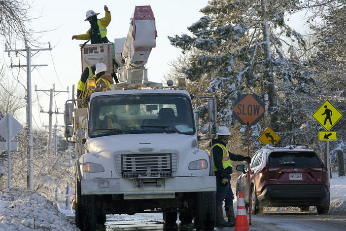
Storms of similar intensity commonly cause major damage to homes, snap or uproot trees, and lead to widespread power outages. Officials have been urging people in the warning zones to prepare for the hurricane's arrival, saying conditions would be too dangerous to complete such work on Friday.
Delta's strength has sharply fluctuated since it became a hurricane on Monday — including explosive growth early on, from 40 mph Monday morning, to a Category 4 hurricane on Tuesday with winds of 130 mph.
Despite that early strength, the storm was relatively small. But it has grown larger as it crosses the Gulf of Mexico's warm waters.
Delta's center is now projecting hurricane-force winds outward for up to 40 miles, and tropical-storm-force winds for up to 160 miles — increasing the area for potential damage from the storm and any tornadoes it might generate on land.
Copyright 2020 NPR. To see more, visit https://www.npr.org.
Bottom Content