Banner Image
Blog

Section Branding
Header Content
This Week In Georgia Weather - February 6, 2012
Primary Content
The mild winter conditions continue, even through the second week of February. Nevertheless, a wedge of cold air has set up over the northeastern corner of the state on Monday, keeping temperatures 5 to 10 degrees lower than the rest of the state. On Tuesday, high pressure will move east of the state, allowing for the wedge to erode and for temperatures to rebound to the 50's. A low chance of rain returns to the state on Wednesday, otherwise we will remain dry through the end of the week. By Saturday, a low pressure system will skirt across the southern third of the state, bringing heavy rain to an otherwise parched area of Georgia. A cold blast of air also returns to the state on Sunday, dipping daytime high temperatures back down to the 30s and 40s. Forecast images courtesy of WrightWeather.com.
This is also Severe Weather Awareness Week! Take the time to review emergency action plans with your family and office in the case of inclement weather. Also be sure to check emergency supplies at this time, both in the house/office and in the vehicle. I will review Georgia's most significant threats from severe weather in a future blog post, coming up later this week.
In the meantime, get set for a Tornado Drill on Wednesday, February 8th at 9am. At that time, the National Weather Service will transmit a practice tornado warning using the Routine Weekly Test. This warning will be transmitted through NOAA Weather Radio, and the test warning will be issued for all 159 counties in Georgia. The practice tornado warningwill expire at 9:30am; in the event of thunderstorms and other convective weather on Wednesday, the drill will be moved to Friday, February 10th at the same time. Keep in mind that a "practice watch" will not be issued before the practice tornado warning; in addition, no "all-clear" message will be issued at the end of the practice tornado warning. The National Weather Service has more information regarding the practice tornado warning airing on Wednesday.

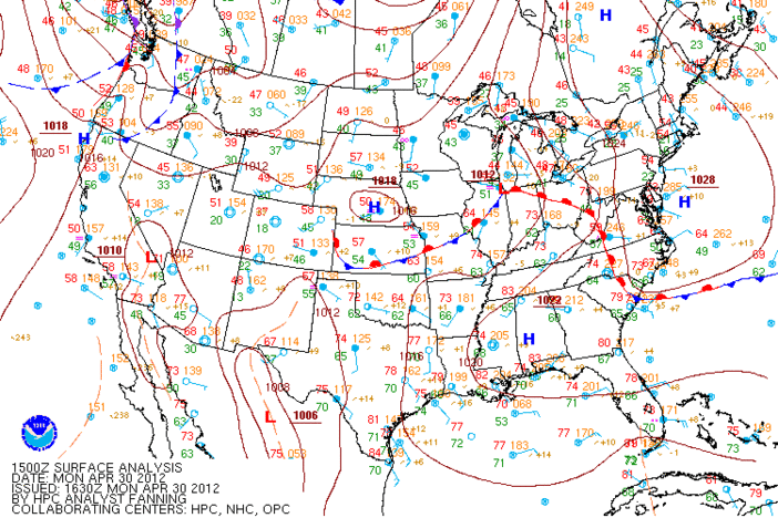
Surface weather map for 1pm Monday, February 6, 2012. Image courtesy of the HPC, the NWS, and NOAA.

Forecast temperatures for 7am Wednesday.

Forecast temperatures for 4pm Wednesday.

Forecast temperatures for 7am Friday.

Forecast temperatures for 4pm Friday.

Forecast temperatures for 7am Sunday./

Forecast precipitation for 1pm Saturday.

The Drought Monitor for January 31, 2012.
Secondary Content
Author

Bottom Content