Section Branding
Header Content
This Week in Georgia Weather: January 23
Primary Content

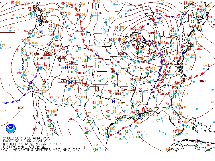
This week's weather started off with a bang as thunderstorms rolled into the northern portion of the state on Monday. Thankfully, we missed out on severe weather that plagued Mississippi and Alabama, but we still received plenty of beneficial rain from the weather system. We should thank the "wedge" for keeping the temperatures in the north-northeastern portion of the state on the cool side, which essentially diminished the development of stronger thunderstorms. As Monday's cold front sags southward through the state, the southern counties will receive rain throughout the evening on Monday (which is great, considering the persistent and pesky presence of the drought). Forecast images courtesy of Wright-Weather.com.
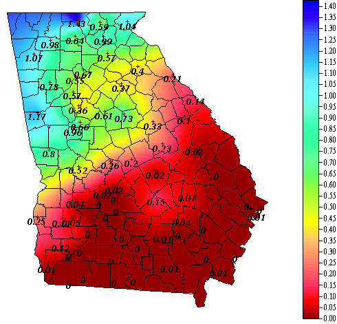
Rainfall totals from 12:00am through 8:15pm on Monday, January 23, 2011. Image courtesy of GeorgiaWeather.net.
The state will receive a breather, precipitation-wise, on Tuesday and Wednesday, while another low pressure system zips down the pacific coast and enters the Four-Corners states. It will build its intensity in Texas, giving us a sneak-preview for what's in store on Friday.
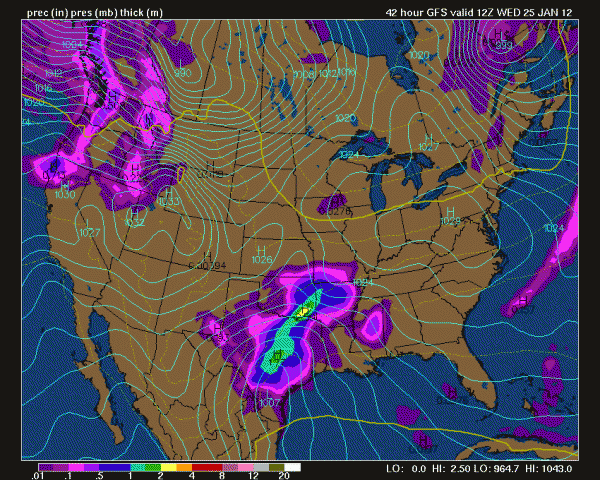
While Georgia remains dry, the next system develops and intensifies over Texas on Wednesday.
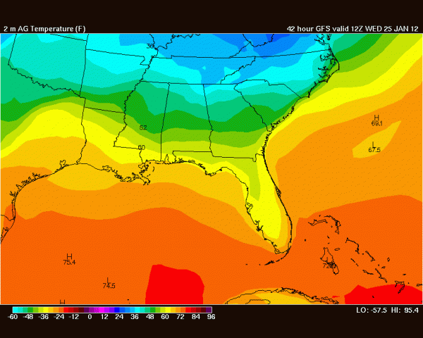
Thankfully, arctic air stays well to the north of the state, allowing for cool conditions at 7am on Wednesday morning.
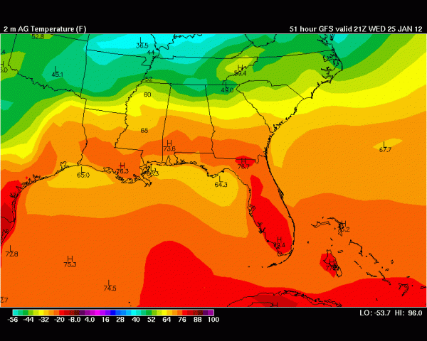
Temperatures rebound nicely into the 50's, 60's, and 70's by 4pm Wednesday.
Rain returns late Thursday and early Friday, as the low pressure system makes its way into Georgia. Another 3/4" to 2" of rain is possible with this system.
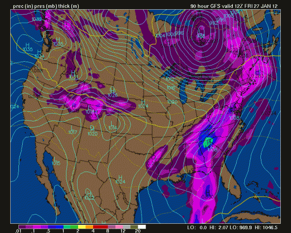
Here comes the rain....again....
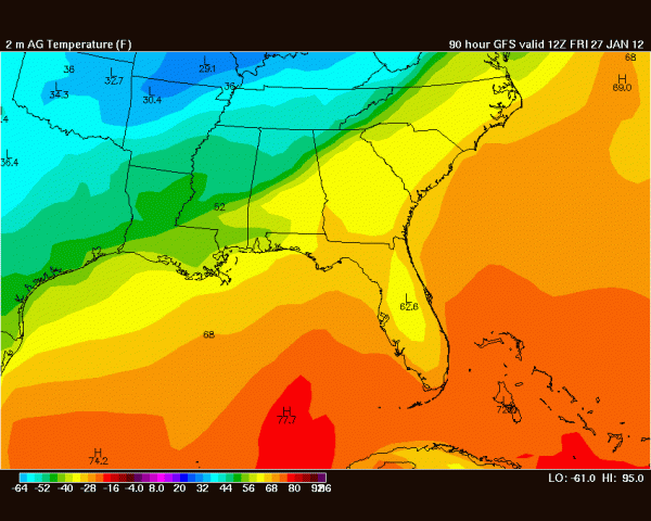
Warm temperatures stick around, even at 7am Friday morning.
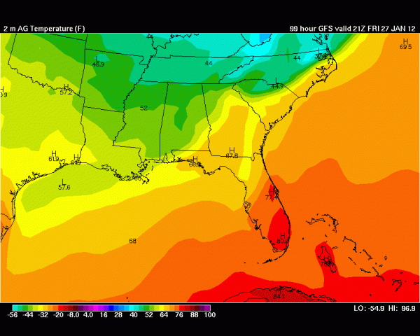
Slight cooling occurs on Friday afternoon.
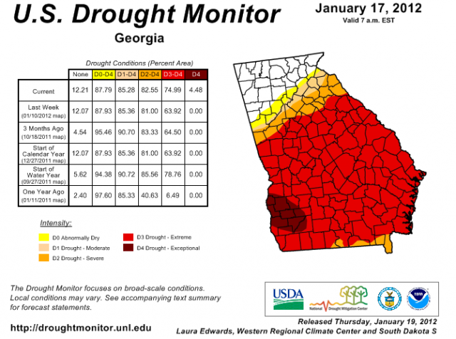
Thankfully, the extra rains are eating away at the drought in the northern third of the state. Unfortunately, the southern two-thirds of the state is experiencing an extreme drought, and rarely receives the same amount of rainfall that the northwest corner receives.
Stay tuned for information about Severe Weather Awareness Week, and how one popular PBS kids' show is getting in on the weather action! In the meantime, happy storm spotting!
Secondary Content
Bottom Content


