Section Branding
Header Content
Tropical Storm Impacting Georgia
Primary Content
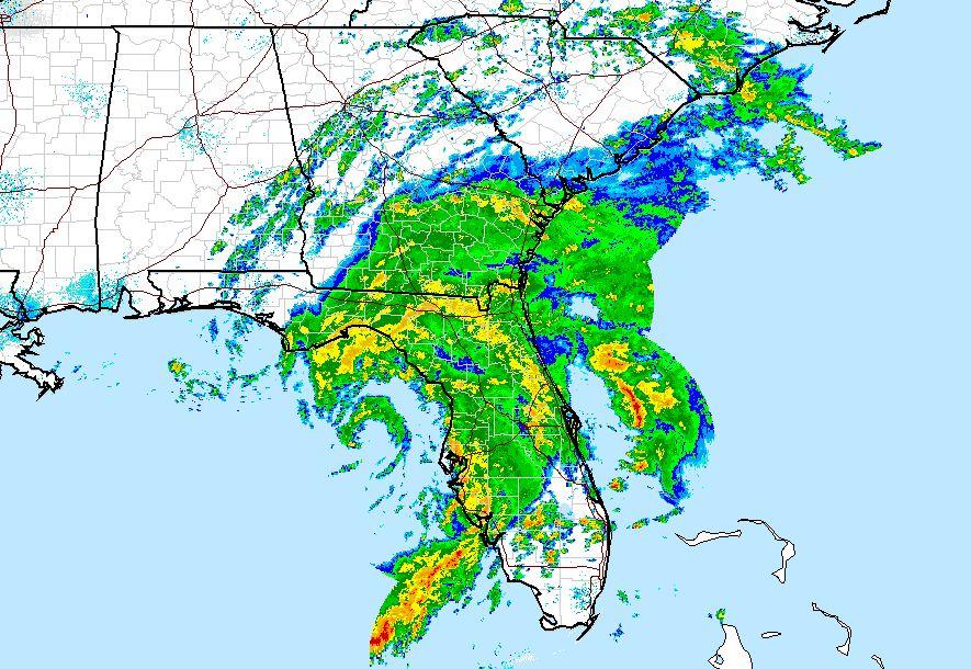
The National Weather Service issued a tropical storm warning Thursday for parts of Georgia, including Berrien, Brooks, Cook, Lanier, and Lowndes counties.
Flood warnings from the NWS stretched into middle Georgia counties late Thursday afternoon.
Keith Stellman, Meteorologist in Charge at the National Weather Service office in Peachtree City, said south Georgia could see dangerous wind conditions.
“The closer you get to the coast, say from Dublin and areas down to Albany and south and east and we’re looking at tropical storm force winds potentially," explained Stellman. "That combined with the already wet soils, we could see some downed trees and power lines as a result of that.”
The NWS also extended a tornado watch through 10 p.m. Thursday for Brantley, Camden, Charlton and Glynn counties.
The National Weather Service issued severe thunderstorm and flash flood advisories as the storm system crossed the state.
At one point, Georgia Power reported more than 4,600 customers across the state were without power. The largest concentration of people affected was in metro Atlanta.
Authorities said more than 100 residents have been evacuated from an apartment building just north of Atlanta after heavy rains damaged a small dam.
The heavy rains and flooding at The Falls at Sandy Springs apartments also led to a gas leak.
Sandy Springs city spokeswoman Sharon Kraun said the Red Cross was assisting those displaced from the apartment complex along Roswell Road early Thursday morning.
In Woodstock, Cherokee County sheriff's Lt. Jay Baker said residents in about 30 homes were stranded in the Hickory Glen subdivision after rain washed away the ground under a road.
Stellman said the rainy conditions would persist for 24 to 30 hours, but would likely clear out for the weekend.
Tags: Georgia, Georgia Power, National Weather Service, flooding, rain, tornado, severe weather, tropical storm, Andrea
Bottom Content